Lake-effect snow: Explaining what it is and how it really works in Metro Detroit
—
DETROIT – Every winter, people in Michigan hear the same phrase on the news: “lake-effect snow.”
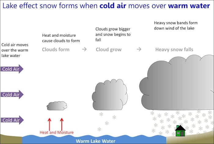
It sounds like something complicated, but the idea is actually pretty simple. Lake-effect snow happens when cold air moves across the warmer Great Lakes, picks up moisture, and drops it as snow once the air reaches land.
Even though Detroit isn’t right next to Lake Michigan, the city still feels the effects in surprising ways. Understanding how this works can make winter weather feel a little less mysterious.
The Great Lakes are huge — almost like small oceans. Because they hold so much water, they don’t freeze right away. In early winter, the lakes stay warmer than the air above them. When a blast of cold air rushes over the water, the lake acts like a giant steam machine. The cold air warms up a little, picks up some of the lake’s moisture, and carries it into the sky.
When this cloud of wet air moves over land again, the air cools down, and snow begins to fall.